Build-Up
Vivamus elementum semper nisi. Aenean vulputate eleifend tellus. Aenean leo ligula, porttitor eu, consequat vitae, eleifend ac, enim. Aliquam lorem ante, dapibus in, viverra quis, feugiat a, tellu
Vivamus elementum semper nisi. Aenean vulputate eleifend tellus. Aenean leo ligula, porttitor eu, consequat vitae, eleifend ac, enim. Aliquam lorem ante, dapibus in, viverra quis, feugiat a, tellu
In India Techno Vision Surveys was established in January 2007 as a Division of Vision International General Trading and Contracting Co. W.L.L, Kuwait based limited liabilities GPS mapping company.
A young and dynamic Company, we are committed to growth through client satisfaction, and we aim to provide professional standards of quality whilst ensuring that completion dates are met. We achieve this by using only skilled, experienced and professionally-qualified staff whose skills are complemented by being equipped with instrumentation which represents the latest advances in survey technology.

Name of Company - TECHNOVISION SURVEYS & MAPPING CO.PVT.LTD (AN ISO 9001 - 2015 CERTIFIED COMPANY)
Office in India - Vision Enclave, 17/27(3) First Floor, Near South Police Station , Opp.Police Quarters, Kunnathurmedu, Palakkad 678013
Email address - info@technovisionsurveys.com
Nature of Business - Surveying and GPS Mapping.
Managing Director - Mr.S.G.Nair (Mobile: +91 9947654664 +91 9446556141)
General Manager (Indian Operations) -Mr. P.P. Prashanth (Mobile: +91 94475804664)
CEO (Indian Operations) - Mr. P.G. Unnithan (Mobile: +91 9447580495)
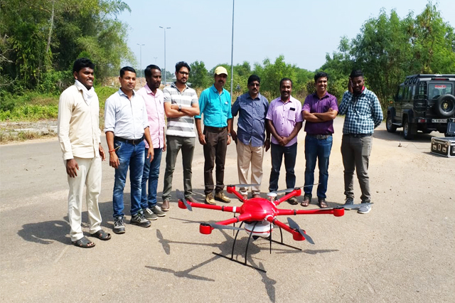
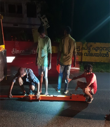
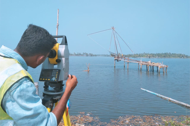
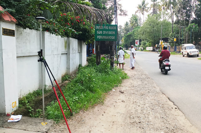
Survey Crews - Up to 7 Survey Crews, configured either as Two-man crew, comprising Surveyor and Assistant, Three-man crew composed of Surveyor, Observer and Survey Assistant. All crews are equipped with appropriate survey instrumentation to carry out the specific work assigned, and a four-wheel-drive vehicle containing all necessary accessories and tools.
The Field Survey Teams are headed by the Survey Manager, S G Nair, who possesses over 25 years experience of working as a Professional Surveyor in the Middle East and South Asia. During this time, he has worked as a field surveyor engaged in performing Topographic surveys, engineering surveys and Hydrographic surveys. Projects on which he has worked have included Heavy Civil Engineering Projects, Pipelines and HT electricity transmission lines. Tasks undertaken have encompassed route surveys, topographic surveys at various scales, the tracing of underground services networks and the establishment of survey control using both GPS and conventional instrumentation.
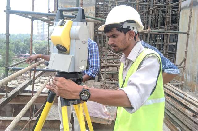
Each Field Survey Team is headed by a Senior Surveyor, who will have had at least 7 years experience in one or more aspects of the profession, including Topographic Survey, Engineering Survey and Hydrographic Surveys, and will be familiar with the operation of both Survey Total Stations and GPS satellite instrumentation.
The Observers and Survey Assistants in the teams use their skills and many years of survey experience to support the work of the Senior Surveyors. The Survey Teams are either configured as two-man or three-man teams, depending on the task being performed, and are equipped with survey instrumentation appropriate to that task.
All survey teams will use a four-wheel-drive vehicle equipped with all the accessories and tools necessary to perform a variety of survey tasks, as required. The vehicles are also fitted with the necessary safety equipment to allow the Team to perform their work in accordance with prevailing Health and Safety Regulations.
The work of the Field Survey Teams is complemented by the professionalism and dedication of the CAD cartographers and software developers in the Company, who work with the latest releases of survey software.
The CAD staffs are selected for their differing specialist skills and experience, and this enables them to work as a team to produce mapping and imagery to high professional standards.
The CAD Department of the Company is presently engaged upon the development of a GIS for Drone Survey Mapping which integrates the base mapping, the cadastral data and the mapping of the road corridors, which, when allied to an intelligent route selection system, promises to reduce the cost and time involved in the planning of optimal routing for proposed roads.
Vision International has always invested in the latest proven technologies in survey instrumentation and software, and adds to its instrument fleet when advances in technology dictate. Currently, the Company operates the following types of surveying equipment:
Data from the field instrumentation is processed through a range of software held by the CAD Department. The Company uses only the latest releases of each software, and packages held include:
Techno vision can offer a full range of Geospatial services to Clients. The Company is continually upgrading its capabilities, but currently can offer:
Technovision has undertaken Prestigious project of KMRL water metro by Drone based Photogrammetric survey.